Know where to live in London.
Prices, schools, safety, commutes and character for every one of London’s 4,994 neighbourhoods, on one map. Describe the life you want and it shows you where fits.
Walthamstow, E17
The real map, live: from all of London down to one house’s estimate. Tap any building.
Find where to live in London, not just what’s for sale.
Most property websites show you available homes. Posh Maps helps you discover the right areas first.
Explore all of London on one interactive map. Compare over 1.15 million buildings, property values, safety, schools, transport, amenities and commute times to find neighbourhoods that match your lifestyle and budget.
Whether you’re renting, buying your first home or investing, discover places you might never have considered, and save time and money finding somewhere you’ll love to live.
Free valuations
What’s your home worth? Free.
Type any London address that has sold since 1995. You get a valuation tested against 58,000 real sales, its price history, its building, who lives nearby, who the area suits, and what the listings say, every fact sourced.
No sign-up. Typical error 10.6%, and we show you the range.
Flat 52, Dundas Court, Greenwich
£0k
Most likely £439k–£534k
Who it suits
What you get
Everything about an area. Before you visit.
What every home is worth.
An estimate for each of London’s 1.15 million buildings, built from 3.7 million Land Registry sales. On homes that sold twice, the typical estimate lands within 12.7% of the real price.
How posh is your postcode?
Any postcode, scored out of 100, with the reasons.
See where prices went.
Thirty years of sales for every street, in real terms or not. Spot the areas on the up before everyone else does.
Walthamstow (Lynmouth Road), median sale price. HM Land Registry.
Strengths, and the weak spot.
Every area shows how it compares with the rest of London, including the score it would rather you didn’t see.
- Amenities94
- Schools87
- Green space79
- Safety74
- Transport72
- Clean air14
52 measures. Your mix.
Combine safety, schools, prices, Census communities and commute into a map that’s about you.
Door to door, not as the crow flies.
Say where you work and how long you’ll travel. Areas outside that drop away, using real public transport journey times.
No ads. No listings. No agents.
Nobody pays to be on this map, and nobody rings you back. Sign in only when you want to keep a shortlist.
How it works
Describe it. Get a shortlist.
Describe it.
Type what you want the way you’d say it to a friend: budget, commute, schools, the feel of the place.
It checks every neighbourhood.
Your words become filters on Land Registry prices, the Census, Ofsted, Police.uk and journey times, run across all 4,994 areas.
You get a shortlist, with the catch.
The closest five, each checked against what you asked for. If nowhere ticks every box, it tells you which one it had to bend.
Then see it on the big map.
Every match coloured on the street map, ranked, with the reason it made the list.
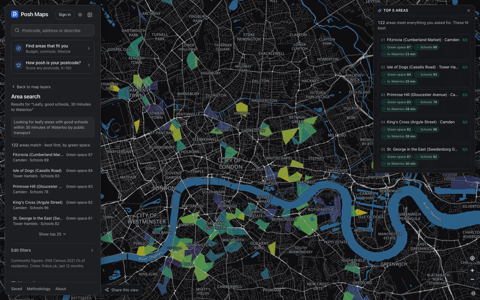
“Leafy, good schools, 30 minutes to Waterloo”: 122 areas match. The top five, ranked.
Area reports
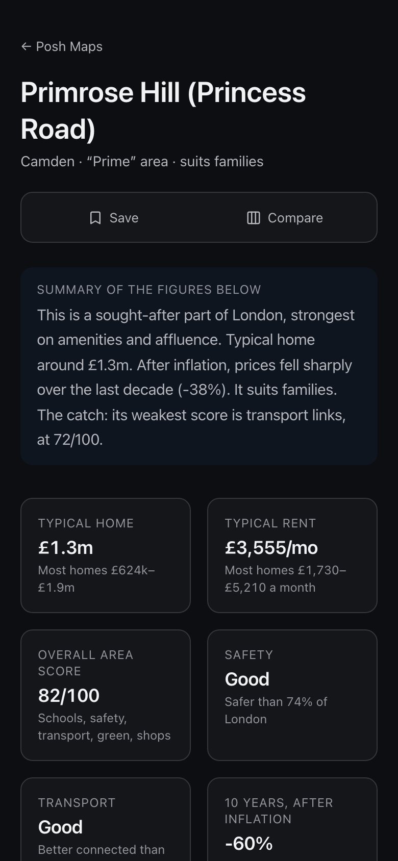
All 4,994 neighbourhoods. Each with its own report.
- Typical price and rent
And the range most homes fall in, so one mansion doesn’t skew it.
- An area score you can unpick
Schools, safety, transport, green space and shops, each against the rest of London.
- Ten years of prices, after inflation
Whether you’d actually have made money.
- A plain-English verdict
Who it suits, what it’s best at, and its weakest score.
The data
Official sources. Working shown.
Every figure links back to where it came from, how many sales or records sit behind it, and how sure we are.
3.7 million sales since 1995
Who lives where, and how they get to work
Inspection ratings for every school
Street-level crime, month by month
Shops, parks, cafés and pubs
Air quality, street by street
Door-to-door public transport times
How close our valuations typically land. We tested them on 39,000 London homes that sold twice, and we publish the result.
How posh is your postcode?
A score out of 100 from what homes are worth, the shops nearby and the housing. Then the reasons, so you can argue with it.
Free. Really.
The whole map, the AI search, every area report and the postcode checker. No ads, no listings, no catch of our own.